Workflows include (but are not limited to) underground service alerts, customer service requests, periodic maintenance activities, inspections and redlining.
×
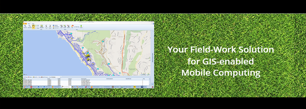
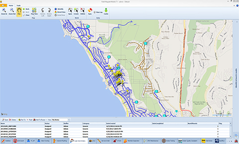
Field Mapplet
An advanced solution for GIS-enabled mobile computing that can be used for all types of field work. Specially designed to automate any workflow that spans both office and field, including departments such as Customer Service, Field Operations, Engineering and Finance departments.
Field Mapplet Features


Can be easily integrated with any organization’s tabular, document and Geographical Information System (GIS) database environments..

Mapplet
Mapplet allows your enterprise to leverage its investment in Geographic Information System (GIS) data. Mapplet allows users access to location aware maps, multi-form tabular data, and other drawings and documents. All departments including Customer Service, Field Operations, Engineering and Finance departments can use this highly innovative map-based viewer to fully utilize their GIS program.
Mapplet Features
Load Mapplet via the cloud or onsite
Build map views specifically to target the needs of different user groups
Quickly build, customize and deploy Mapplet