×
Geographical Information System
Edgemap harnesses its nearly 50 man-years of experience in AM / FM and provideslow-cost, quality- and technology-driven GIS utility mapping services to its clients in different continents. Our expertise span user needs analysis and GIS database creation and maintenance.
We serve a broad spectrum of utility companies with our utility mapping services. These companies include wate ... Read more
We serve a broad spectrum of utility companies with our utility mapping services. These companies include wate ... Read more

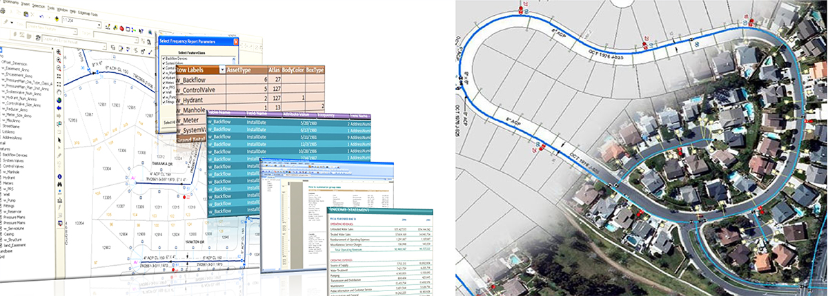
Potable Water and Wastewater (Sewer)
Water and Sewer facility data play a major role in any Utility industry. Creating GIS Water and Sewer facility data for forecasting, water vulnerability, water loss tracking, mainline breaks, water violations, water budgeting, forecast the demand, planning for water recycle, supporting long term supply is very important. water and sewer GIS database will help the geographic intelligenc ...
Read more
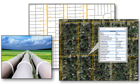
Oil & Gas
Oil and gas are amongst the most important resources that you have. Oil and gas companies are interested in agreements, date of installation, pipe material, pipe maintenance or repair, spatial location of asset and historical data. To achieve all these, Edgemap offers a utility conversion services which are mentioned below to your industry, that will help you to improve the cost-efficiency a ...
Read more
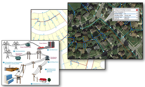
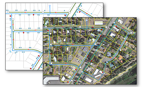
Electric
The importance of mapping Electric data into GIS environment is to provide spatial solutions in a real time manner for quick solutions. In today’s world the major problems identified in this Electrical domain are (a) frequent power failure due to manual and natural disaster, (b) Unequal transmission of load, (c) Rupture on equipment due to improper maintenance, etc.
Edgem ... Read more
Edgem ... Read more
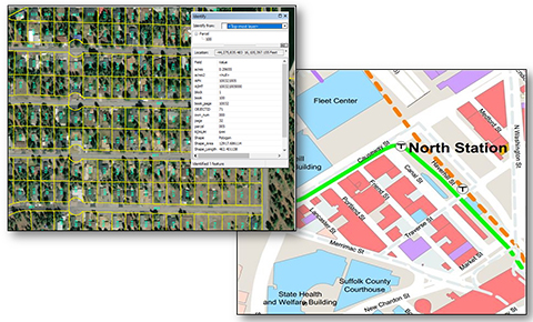
Landbase Administration
Land policy deals with parcel of land such as (a) agricultural land, (b) forest land, (c) land for housing, infrastructure etc. It typically includes laws and regulations as well as administrative structures and programmes.
Creating and maintaining a record that represents graphically and has information on their ownership such as addresses, dimensions, tax details and other info ... Read more
Creating and maintaining a record that represents graphically and has information on their ownership such as addresses, dimensions, tax details and other info ... Read more